Geospatial Data Science with R
Last updated 11/2023
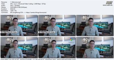
Created by Dr. Xiao Ping (XP) Song
MP4 | Video: h264, 1280x720 | Audio: AAC, 44.1 KHz, 2 Ch
Genre: eLearning | Language: English + srt | Duration: 47 Lectures ( 4h 0m ) | Size: 2.8 GB
Learn the skills to work effectively with spatial data for real-world applications. No prior coding experience required.
What you'll learn
Hands-on learning with step-by-step code walkthroughs after each lecture
Fully downloadable code notebooks complete with scripts, data processing workflows, and accompanying explanations
All slides available as downloadable PDF
No prior coding experience needed!
Set up the computing environment for R programming following best practices
Utilize RStudio, R Projects and R Markdown Notebooks for coding efficiency and reproducibility
Use appropriate syntax, data structures, functions and software packages in R
Understand and differentiate between various representations of spatial data, such as vector and raster formats
Load, process and export spatial datasets, including those that exceed available memory (RAM)
Select and use the appropriate coordinate reference systems
Apply geometry and spatial operations to manipulate vector data
Manipulate and summarize raster data to extract information from satellite imagery and other sources
Create interactive and publication-ready maps and visualizations
Develop workflows to automatically process and visualize geospatial data
Apply techniques learnt to real-world problems in environmental monitoring and population demography
Requirements
No programming experience needed. We will set up the computing environment together and cover the fundamentals of coding
Basic understanding of geospatial concepts and data is beneficial but not mandatory
A computer to follow along with the coding exercises (MacOS, Windows). This will help you practice and reinforce your understanding of the techniques learnt
Description
Embark on an exciting journey into the world of geospatial data science, and open up new possibilities for your research, business and projects. This course will equip you with the necessary skills to analyze, manipulate, and visualize spatial data using powerful tools and software libraries within the open-source R geospatial ecosystem.What you'll learn:Throughout the course, I will guide you step-by-step to achieve the following learning objectives:Set up R Environment: Follow best practices in setting up your computing environment using RStudio, R Projects and R Markdown NotebooksR Fundamentals: Utilize appropriate syntax, data structures, functions and software packages for the given analysisUnderstand Spatial Data: Recognise the differences between vector and raster formats, and how various types of spatial data can be represented and analyzedHandle Spatial Datasets: Learn the techniques to load, process, and export spatial datasets, even when dealing with large files that exceed available memory (RAM)Coordinate Reference Systems: Learn the importance of coordinate reference systems (CRS) and be able to select and apply the appropriate CRS for your analysesVector Data: Apply geometry and spatial operations to manipulate vector dataRaster Data: Manipulate and summarize raster data to extract information from satellite imagery and other sourcesData Processing Workflows: Develop scripts to automatically process and visualize geospatial dataCreate Engaging Visualizations: Develop publication-ready maps and visualizations to effectively communicate your findings to a broader audiencePractical Applications: Apply your newfound skills to perform environmental monitoring and analyze population demographyThis course comes with:Comprehensive slides: Access all slides, which include example code and links to resourcesHands-on Learning: Step-by-step code walkthroughs after each lectureCode Notebooks: Complete with scripts, data processing workflows, and accompanying explanationsQuizzes and Exercises: Strengthen and test your understanding of concepts that you've learntLifetime Access: Enjoy unlimited access to all future updatesUdemy Certificate of CompletionRisk-free Learning: A 30 Day "No Questions Asked" Money Back Guarantee!About me:Hello and welcome! I'm Dr. Xiao Ping (XP) Song, your course instructor. In my professional journey, I have been deeply involved in developing metrics and predictive software for city planning and sustainability reporting. My research and teaching focus on applied machine learning and geospatial techniques. Throughout my career, I have taught bachelor- and master-level courses, coding workshops and music classes, and have had the privilege of receiving multiple teaching awards.As an educator, I find that students are best motivated when they grasp underlying concepts and are inspired by what they see. That's why, in our class, we will dive right into interesting and practical examples. We will take a hands-on approach, by actively applying our knowledge to real-world scenarios through a step-by-step process.Are you ready?What sets this course apart from typical data science offerings is our unique focus on spatial problems. Spatial problems offer a visually rich landscape for exploration and analysis, and in this course, we'll immerse ourselves in engaging, hands-on examples. Whether you're an absolute beginner or a seasoned professional, I'm confident you will gain valuable insights and practical skills that you can take away and apply immediately. Join me as we embark on this new journey of learning-I look forward to seeing you in class!Sincerely,Xiao Ping (XP) Song
Who this course is for
Beginners who want to use geospatial data as a stepping stone into coding
Data scientists, researchers or developers who want to start working with spatial data and the open-source geospatial ecosystem
Geospatial or GIS professionals seeking to automate and enhance the reliability of their work
Screenshots

Download link
rapidgator.net:
https://rapidgator.net/file/c6513c689dc42335f0869b900f63455b/clrno.Geospatial.Data.Science.with.R.part1.rar.html
https://rapidgator.net/file/08c9d5a376634a8edc06a30759620543/clrno.Geospatial.Data.Science.with.R.part2.rar.html
https://rapidgator.net/file/141435683eb12fe3d103cdd34a5ead6f/clrno.Geospatial.Data.Science.with.R.part3.rar.html
uploadgig.com:
https://uploadgig.com/file/download/C428d558E56b6e00/clrno.Geospatial.Data.Science.with.R.part1.rar
https://uploadgig.com/file/download/5b8f6f93c21895bf/clrno.Geospatial.Data.Science.with.R.part2.rar
https://uploadgig.com/file/download/499f0327e1D026bd/clrno.Geospatial.Data.Science.with.R.part3.rar
ddownload.com:
https://ddownload.com/phgieprg0ugg/clrno.Geospatial.Data.Science.with.R.part1.rar
https://ddownload.com/n08094ggxwo4/clrno.Geospatial.Data.Science.with.R.part2.rar
https://ddownload.com/56y5foq2i4es/clrno.Geospatial.Data.Science.with.R.part3.rar